



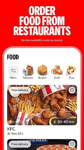

Yango is a leading ride-hailing app designed to simplify urban mobility. This innovative platform connects users with a network of drivers across 19 countries, including Ghana and Senegal. With its intuitive interface, Yango makes city navigation effortless while offering multiple service classes to suit different preferences and budgets.
The app stands out with its advanced safety features, smart destination suggestions based on user history, and the ability to manage complex trips with multiple stops. Whether you need a quick ride home or want to coordinate transportation for friends and family, Yango provides a comprehensive solution that enhances both convenience and efficiency in urban transportation.
Yango distinguishes itself through its robust feature set tailored for modern urban commuters. The app offers various service classes ranging from budget-friendly Economy rides to premium Comfort options, ensuring there's an appropriate choice for every occasion. Its international presence across 19 countries makes it a versatile travel companion for both local residents and frequent travelers.
What sets Yango apart is its commitment to safety and convenience. The app provides real-time driver information, including vehicle details and ratings, while allowing users to share their ride status with trusted contacts. Additional features like multiple destination handling, ride ordering for others, and personalized destination suggestions based on user behavior patterns demonstrate Yango's dedication to creating a smarter, more efficient transportation experience.
Map accuracy is essential for any navigation app, and Yango excels in this area. The application provides precise location data, ensuring that users can navigate the city with confidence. By leveraging advanced mapping technologies, Yango delivers up-to-date and detailed maps that cover extensive areas, including lesser-known streets and alleys.
Yango's dedication to accuracy means that users receive real-time updates on their location, the position of their ride, and potential traffic conditions. This feature is particularly beneficial in bustling cities where road conditions can change rapidly. With Yango, you are always aware of your surroundings and can make informed decisions about your travel route.
The advantages of Yango's accurate mapping are manifold. Not only does it enhance the overall user experience by reducing travel time and increasing reliability, but it also contributes to safety. Knowing exactly where you are and where your driver is fosters a secure environment, minimizing the chances of getting lost or encountering unexpected situations.
Route planning is another cornerstone of Yango's Maps & Navigation capabilities. The app offers multiple route options, allowing users to choose the most suitable path based on their preferences for speed, distance, or avoiding tolls. This flexibility ensures that every journey is optimized according to individual needs, making each ride as efficient as possible.
In addition to offering various routes, Yango provides real-time traffic updates and estimated arrival times. These features enable users to adjust their plans dynamically, avoiding congested areas and reaching their destinations faster. Whether commuting to work during rush hour or exploring new parts of the city, Yango's intelligent routing keeps you moving smoothly.
Ultimately, Yango's route planning empowers users with control over their travel experience. By delivering timely information and alternative paths, the app reduces stress and enhances convenience. Users can trust Yango to guide them through the urban landscape efficiently, ensuring they arrive at their destination relaxed and on time.
User-friendly interface
Multiple service classes
International availability
Advanced safety features
Smart destination suggestions
Limited emergency support
Occasional surge pricing
Variable driver quality
Regional service gaps
Technical glitches possible
Compass is an accurate compass and a great tool for any outdoor activities
 4.5
4.5
Find AI powered cameras, ALPRs, and other surveillance infrastructure near you
4.70
Offline maps for phone and smart watch: topographic maps, satellite images...
3.30
Discover over 800 points of interest along the canal.
3.70
Navigate with your watch and keep the phone in your pocket!
4.60
Drive safe with real-time speed camera radar, police, and traffic alerts
3.80
GPS Navigation: Get map directions and find the shortest routes to avoid delays!
4.00
Navigation, weather, offline maps & tools for smarter, safer travel planning.
4.00
Rideshare, taxi cabs, and more for your airport travels and everyday trips.
4.50
This app is military GPS coordinate systems helper. (MGRS, UTM & DMS Maps)
4.80
Plan routes, share locations, and set custom alert zones
4.40
Lets explore the world's famous places by using Live Cams, GPS & Satellite View.
4.20
Navigate seamlessly with Real-Time Traffic, Offline Maps, and Voice Navigation.
4.10
TACNAV-X: Precision MGRS navigation, built specifically for the military.
4.00
MapQuest is your go-to app for maps, GPS, voice navigation & live traffic.
3.80
OpenCPN is a full featured ChartPlotter and Navigator for Android.
3.60
Off-Roading Navigation App With Trails, Public Lands, & Private Property Info
3.30
Ride CTA, Metra & Pace: Manage your fares, buy Metra tickets, get arrivals.
3.00
All of NHSA's trail information at your fingertips for the 2025-2026 season
4.0
Complete Lyft review—pricing comparison, driver quality, safety features, rewards program, and how it stacks up against Uber and competitors.



User Reviews